
Ceres Imaging
Decision-grade aerial imagery and agronomic insights for agriculture and ag finance
Choose Ceres AI when you need aerial imagery and analytics you can stake money on — think multimillion-dollar farm loans, insurance claims, or multi-country sustainability reporting. Its conductance-based water stress data and expert-backed interpretation are genuinely differentiating. But it's a consultative service with custom pricing, not a self-serve tool, so small farms and budget-conscious teams should look elsewhere.
Verified 7d ago · liveness 60/100 · cite: rightaichoice.com/tools/ceres-imaging
We scan live Reddit threads, YouTube comments, X posts, G2 reviews and other communities — and hand you an honest verdict in under a minute.
- Honest verdict, not marketing
- Real pros & cons from real users
- Attributed quotes with receipts
3 free scans · no card needed
Skip Ceres AI if you need immediate self-serve pricing, a free trial, or fully automated analytics without expert support; it's tailored to large enterprises and financial institutions that can invest in a consultative process.
Because pricing is custom and consultation-based, you may not know the full cost until after scheduling a call; there's no public price list to compare upfront.
Ceres AI's custom pricing fits large agribusinesses and ag finance institutions that need research-backed risk insights; cheaper self-serve tools like FarmQA or Climate FieldView alone won't offer the same depth, while enterprise-grade platforms like Descartes Labs or Planet may have comparable costs.
In short
Ceres Imaging — Decision-grade aerial imagery and agronomic insights for agriculture and ag finance. Contact Sales pricing.
Viability Score
How well maintained and how widely used is Ceres Imaging? Built from what the vendor actually publishes (docs, changelog, tutorials, integrations, pricing), whether the site is live, and how much real users discuss it. How we calculate this
Last calculated: September 2026
How we score →About Ceres Imaging
Ceres AI, formerly Ceres Imaging, is a decision-grade platform that fuses multispectral aerial imagery with expert agronomic interpretation. It's built for global farming enterprises, insurers, lenders, and sustainability teams who need defensible, research-backed data to protect yield, manage climate risk, and improve portfolio resilience. With a dataset of more than 11 billion plant-level measurements and over 30 research collaborations, Ceres doesn't just show you where problems are — it models yield impacts and ROI to guide investment decisions and in-season responses. The core offering is per-plant crop health data captured by aerial flights, with flexible tasking that can acquire imagery within 48 hours of a damage event. Insights are delivered within hours of capture, not days. Its proprietary conductance measurement correlates strongly with applied water, giving growers a precise tool for irrigation and fertilizer management. You also get custom sustainability scorecards that digitally monitor farm practices, plus yield impact modeling that quantifies the financial cost of stress events. Where Ceres differs from generic remote sensing tools is the human layer. Every deployment includes expert agronomic support and project management — the team helps you interpret the data and act on it. This makes it a service rather than a self-serve analytics dashboard. A confirmed integration with Bayer Climate FieldView lets data flow directly into farm operations, though other software ties are limited. Pricing is customized and consultative; there's no public tier list, so expect to schedule a consultation to get a quote. Ceres positions itself as the premium, high-touch option for organizations that need accuracy they can defend, whether for a loan decision, an insurance claim, or a sustainability report. Smaller operations may find it overkill — but for enterprises and financial institutions, this depth of analysis and support is the point.
Behind the Verdict
Let's be blunt: Ceres AI isn't for everyone, and it doesn't pretend to be. If you're a family farmer with a few hundred acres, the consultative sales process and custom pricing will likely price you out — and you probably don't need 11 billion plant measurements to make your decisions. Simpler tools like FarmQA or basic drone imagery might serve you better. But if you're an agribusiness managing 50,000 acres, a lender underwriting farmland, or an insurer appraising claims, the picture changes. What you're paying for is confidence — the ability to say 'we know this field's yield impact to within X percent' and back it with data that has held up in research collaborations with universities and government partners. The standout feature is the conductance measurement for water stress. As one UC Cooperative Extension researcher put it, it provides the best correlation with applied water of anything he's tested — better than a dozen soil moisture probes. That's not marketing puff; it's an agronomist's validation. For anyone in a water-constrained region, that alone justifies a serious look. Another thing we appreciate: the service wraps the imagery in human expertise. You're not staring at NDVI maps and guessing. The Ceres team helps you model the ROI of interventions, set up tasking windows that respect your irrigation schedule, and interpret results. That's a real differentiator, but it also means you're dependent on their schedule and their team. If you're looking for a fully automated, no-touch analytics platform, this isn't it. The Bayer Climate FieldView integration is confirmed and valuable — it drops Ceres insights into the platform many growers already use. But beyond that, integrations are sparse, so check if your preferred farm management software is supported
Researching Ceres Imaging? Get your full AI stack in 60 seconds.
Free, no signup — tell us your goal and get tools matched to your budget & existing stack.
Real-world workflow fit
Concrete scenarios for the personas Ceres Imaging actually fits — and what changes day-one when you adopt it.
You need to identify irrigation anomalies across 10,000 acres to reduce water waste.
Outcome: You schedule a tasking flight, receive plant-level imagery within 48 hours, and get expert-interpreted irrigation recommendations that pinpoint specific areas to adjust, cutting water use.
You're underwriting a loan for a large farming operation and need to assess yield risk.
Outcome: You use Ceres AI's portfolio risk profiling to analyze historical vegetation indices and yield models, quantifying risk and making a data-backed lending decision.
You must track water use efficiency across multiple farms for a sustainability report.
Outcome: You generate custom sustainability scorecards using Ceres AI's conductance data, showing water use patterns and supporting your reporting with plant-level measurements.
Use Cases
- Detect irrigation anomalies and apply water precisely to reduce waste
- Pinpoint nitrogen stress in almonds to target fertilizer applications
- Verify crop damage for insurance claims with plant-level imagery
- Monitor sustainability metrics like water use efficiency across large portfolios
- Assess yield risk in lending portfolios using historical vegetation indices
- Conduct in-season risk management for climate impacts
Limitations
- Ceres AI does not disclose a self-service pricing model; plans are customized and require scheduling a consultation.
- Imagery is captured via aerial platforms and insights are delivered within hours, with flexible tasking for time-sensitive captures within 48 hours.
- Data access is available on mobile, tablet, and desktop devices.
as of 2026-08-28
Verification history
We have re-verified Ceres Imaging 17 times since . Each pass re-reads the vendor's own pages and re-checks every listed field against that evidence; passes where nothing had changed are marked as such.
- — re-verified summary, description, our verdict, our analysis, pricing model, pricing tiers, features, integrations, who it suits, who should skip it
- — re-verified summary, description, our verdict, our analysis, pricing model, pricing tiers, features, integrations, who it suits, who should skip it
- — re-verified summary, description, our verdict, our analysis, pricing model, pricing tiers, features, integrations, who it suits, who should skip it
- — re-verified summary, description, our verdict, our analysis, pricing model, pricing tiers, features, integrations, who it suits, who should skip it
- — re-verified summary, description, our verdict, our analysis, pricing model, pricing tiers, features, integrations, who it suits, who should skip it
- — re-verified summary, description, our verdict, our analysis, pricing model, pricing tiers, features, integrations, who it suits, who should skip it
Showing the 6 most recent of 17 verification passes.
Free to cite with attribution — this page re-verifies continuously.
Where the pricing makes sense
The company stage and team size where Ceres Imaging's pricing actually pencils out — and where peers do it cheaper.
Ceres AI's custom pricing fits large agribusinesses and ag finance institutions that need research-backed risk insights; cheaper self-serve tools like FarmQA or Climate FieldView alone won't offer the same depth, while enterprise-grade platforms like Descartes Labs or Planet may have comparable costs.
Setup time & first value
How long it actually takes to get something useful out of Ceres Imaging — broken out by persona, not the marketing-page minute.
For a new client, expect a consultation to define needs, then onboarding with imagery tasking and dashboard setup within days; first actionable insights typically arrive within a week of the initial flight.
Switching to or from Ceres Imaging
How to bring data in from common predecessors and how to get it back out — written for the switcher, not the buyer.
- →From FarmQA: Ceres AI offers more advanced research-backed analytics and expert support; you can import your farm boundaries and historical data to get deeper yield and risk insights.
Resources & Guides
Tutorials & Learning
Ceres Imaging: Turning Data Driven Insights in Action for Agriculture
Lemnos
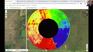
Ceres Imaging Demo for 2020 TAPS
UNL TAPS
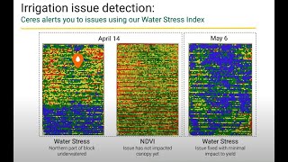
How High Resolution Imagery Can Improve Your Operation - Featuring Ceres Imaging and WiseConn
WiseConn
YouTube returned 6 videos for “Ceres Imaging”, and we withheld 2: 2 did not mention Ceres Imaging. Showing the 4 we can prove are about Ceres Imaging.
Official links
Tools that pair well with Ceres Imaging
Common stack mates teams adopt alongside Ceres Imaging, with the specific reason each pairing earns its keep.

ThinkLabs AI
AI decision engine that helps you evaluate, compare, and select AI tools with confidence.

BlazeSQL
AI data analyst that translates plain English questions into SQL insights from your database.
Sigma Computing
Sigma Computing: AI runtime for governed analytics apps, agents, and insights on live warehouse data
Alternatives to Ceres Imaging
View all
ThinkLabs AI
AI decision engine that helps you evaluate, compare, and select AI tools with confidence.

BlazeSQL
AI data analyst that translates plain English questions into SQL insights from your database.
Sigma Computing
Sigma Computing: AI runtime for governed analytics apps, agents, and insights on live warehouse data
Frequently Asked Questions
Categories
Best-of guides
Topics
Used Ceres Imaging? Help shape our editorial sentiment research.